01 What ouRGeo is
A desktop spatial IDE that keeps R at the centre — ArcGIS Pro’s interface, RStudio’s transparency.
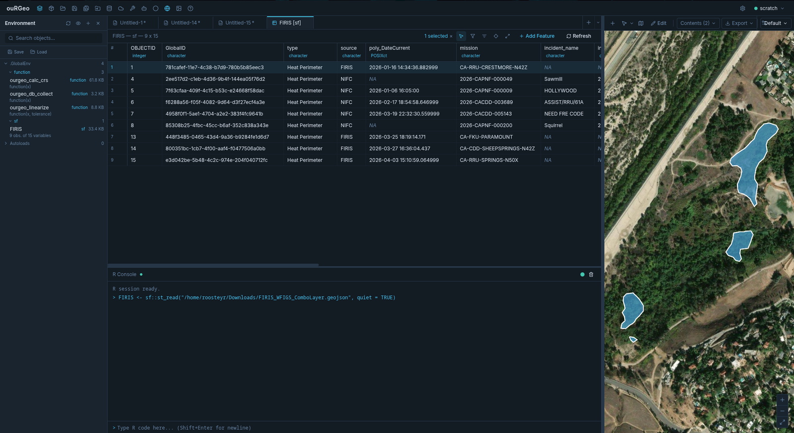
ouRGeo is a free, AGPL-3 licensed desktop application for spatial analysis. It gives you
a map canvas, a layers panel, a geoprocessing toolbox and a digitizing environment
— the tools you’d expect from a GIS — but it runs every one of them
on R’s spatial stack (sf, terra, ggplot2,
tmap) and shows you the code as it goes.
It runs entirely on your machine. There is no telemetry and no cloud dependency; an internet connection is only needed if you pull data from a web service or use a hosted AI model. An ourgeo.dev account is free and entirely optional — it exists for the community forum and for installing plugins from the plugin store, and nothing else asks for one.
02 Install and one-time R setup
Grab an installer from the Download page. Windows and Linux builds are available today; macOS is on the roadmap.
R 4.1 or newer is required and is installed separately from ouRGeo. Follow the
Windows or
Linux instructions to install R,
install ouRGeo and run the required R package commands in PowerShell or your Linux terminal.
Use the same Rscript executable in the terminal and in Settings → R Backend.
The core packages (httpuv, jsonlite, later and
httr2) must be installed before ouRGeo can connect to R; the download page
also lists packages for optional spatial and database features.
On Debian or Ubuntu, an N: Download is performed unsandboxed as root
notice or a skipped AppArmor profile message does not stop installation. If APT
reports Setting up ourgeo, the package installed successfully.
03 Your first five minutes
ouRGeo always opens into a scratch project — a clean R session that you can experiment in freely and never have to name or save.
- Check R connected. A small status dot sits next to the project name at the top right. If R did not start, open Settings → R Backend and pick an installation.
- Load something. Press Load Data in the toolbar and open a shapefile, GeoPackage, CSV or GeoTIFF — or press Data Connector and pull a layer straight from a public web service.
- Look at the console. The import you just clicked through emitted an R command. That is the whole idea — see below.
- Put it on the map. Open the spatial editor with the globe button, then use Add Features to add your layer to the map.
- Run a tool. Open the Toolbox, pick something like Buffer, and watch the Code Preview build the R as you fill the form.
- Keep the work. Either Save As a
.ourgeoprojproject, or turn on recording and walk away with a runnable script.
04 The one idea that matters
Every GUI action has a matching R command, and you always get to see it.
When you buffer a layer, run a join, reproject, compute a distance or draw a feature through the interface, ouRGeo does not perform a hidden internal operation. It writes the real R command and runs that in your session, echoing it to the console exactly as if you had typed it.
# What appears in your console after clicking through Toolbox → Buffer
parcels_buffered <- sf::st_buffer(parcels, units::set_units(50, m))
Three things follow from that:
- Your click-through is an audit trail. Anyone can read the console and see precisely what was done to the data, in a language they can check.
- You can leave the GUI at any point. The objects the toolbox creates are ordinary R objects in your environment. Type at the console, edit them, model them, hand them to a package the GUI knows nothing about.
- Point-and-click work is reproducible. Not "reproducible in principle" — you can literally copy the commands into a script and re-run them.
05 Recording a session
Seeing the code is useful; keeping it is better. The Record Console button (the circle icon in the toolbar) appends every command your session generates to a file of your choosing.
.R file on disk.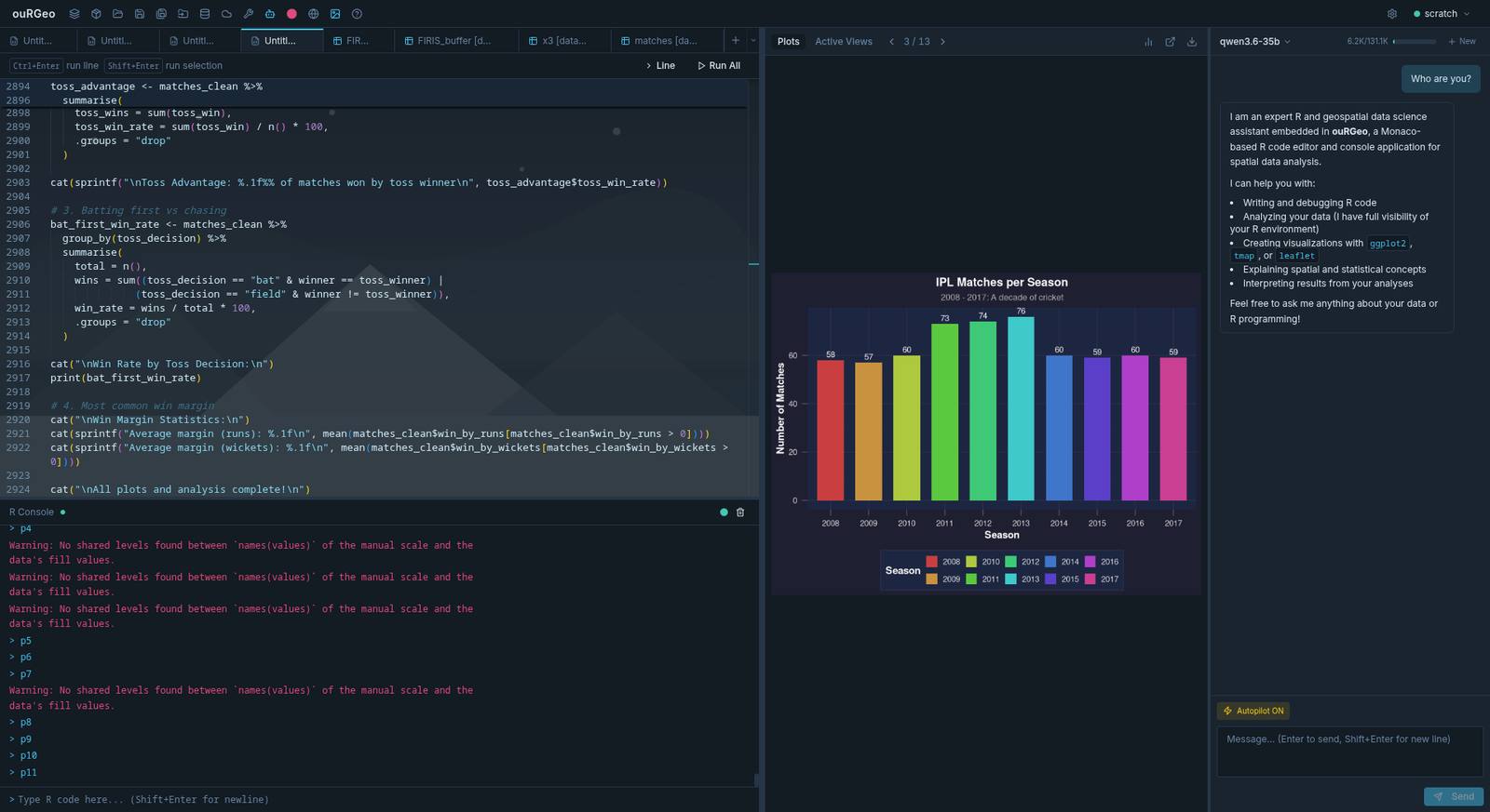
06 Projects, scratch and what persists
ouRGeo has two modes of working, and the difference matters because it decides what survives a restart.
The scratch project
What you launch into. A clean R environment every time, and it cannot be saved in
place — Save is disabled, and closing or switching away never prompts you.
Its code tabs are the exception: your open .R files and untitled
scratch tabs are deliberately kept across restarts, and they come back even if you
have been working in a named project in between.
Named projects
Save As turns scratch into a real project: a portable
.ourgeoproj file. It is a single bundle holding your code tabs, R
environment, map layers, view and legend settings, plots, and any connected
databases — so opening it elsewhere restores the whole workspace, not just the
scripts.
- Load resets the R session, restores the saved objects, then reconnects any
.Rgeodatabases so their lazy table references work again. - Dirty tracking applies to named projects only. Changing the environment, layers or plots marks the project modified.
- On quit, a modified named project prompts Save / Don’t Save / Cancel. Your code tabs are written out whichever you choose.
- Recent projects — the last five are listed in the project dropdown.
Crash recovery
Layers, console history, plots and data-viewer tabs are autosaved continuously during a session and deleted on a clean exit — so a normal launch is always clean, but a crash leaves everything behind to be recovered.
07 Keyboard shortcuts
| Keys | Where | Action |
|---|---|---|
| Ctrl+Enter | Code editor | Run the current line and advance the cursor |
| Shift+Enter | Code editor | Run the selection (or the current line if nothing is selected) |
| Enter | Console | Send the command |
| Shift+Enter | Console | Insert a newline instead of sending |
| Ctrl+Space | Code editor | Trigger autocomplete manually |
| Ctrl+O | Anywhere | Open a file |
| Ctrl+S | Code editor | Save the active tab |
| Ctrl+N | Code editor | New tab |
| Ctrl+W | Code editor | Close the active tab |
| Ctrl+Shift+= / - | Anywhere | Zoom the interface in / out |
| Ctrl+Z / Ctrl+Y | Drawing | Undo / redo — draft edits first, then staged commits |
| Enter | Drawing | Commit the geometry and advance to the next row |
| Esc | Drawing | Finish and close the drawing session |
| Backspace | Drawing | Remove the last vertex |
| N | Drawing | Save the current part, start the next |
| H | Drawing | Start a hole in the polygon |
| B | Drawing | Distance & Bearing — type the next course instead of clicking |
| U | Drawing | Curve — the same strip, starting on a curved course |
| Ctrl+C / R / D | Terminal | Go to the shell unchanged — interrupt, reverse-search, end of input |
| Ctrl+Shift+C / V | Terminal | Copy / paste (everything else is the shell’s) |
| Ctrl+Shift+F | Terminal | Search the scrollback |
| Ctrl+= / - | Terminal | Text size in the focused terminal |
08 Troubleshooting
R will not connect
- Confirm R 4.1+ is installed and that
Rscriptis on your PATH. - Check the four core packages are present:
httpuv,jsonlite,later,httr2. Without them the backend cannot start. - If you recently upgraded R, rebuild your packages
(
update.packages(ask = FALSE, checkBuilt = TRUE)). - Point ouRGeo at a specific interpreter with Settings → R Backend → Browse for Rscript….
A tool fails on curved geometry
Some operations are GEOS-only and cannot handle true arcs. Tick Linearize curved geometry before calculation in the tool form — see Linearize and Calculation CRS.
Buffer or area results look wrong
Almost always a CRS problem: planar maths on lat/lon data. Set a Calculation CRS on the tool, or leave it on Auto-detect, which picks a UTM zone from your data. Details in the toolbox docs.
A raster layer vanished from the map
Raster map layers are tied to the R object backing them. If that object is replaced or removed, the layer is invalidated; ouRGeo re-registers it automatically where it can and drops it where it cannot. Re-add it from Add Features.
The window went black after sleep
Known behaviour of the underlying graphics stack. ouRGeo forces a repaint on resume; if a window stays blank, resizing it triggers a redraw without losing state.
Still stuck
Ask on the community forum. Include your OS, ouRGeo version, R version, and the console output — the console text is the single most useful thing you can paste.
09 Where to next
.Rgeo databases, and the R helper functions behind them.Elsewhere
- Features — the tour of what makes ouRGeo different, if you have not read it.
- Download — installers and system requirements.
- Community forum — questions, bug reports and workflows.